Help Keep Your Georgetown Roads from Flooding…
 Each year, since Fall 2015, groups of civil and environmental engineering seniors from the University of New Hampshire have been evaluating culverts along roads on Georgetown. The culverts evaluated are selected by the Road Commissioner, Charlie Collins. The students collect data on the culverts’ size, materials, condition, and elevation relative to the road. The size of the watershed served by each culvert is also determined using a new map the students produced in 2018 using the latest information available from the State of Maine’s GIS database. Each culvert’s ability to pass the 2, 10, 25, 50 and 100 year storms is estimated. (A 2 year storm has a probability of 1 in 2 or 50% of occurring in any given year. Likewise, a 100 year storm has a probability of 1 in 100 or 1% of occurring in any given year.) This information, along with photographs, is placed in the Road Commissioner’s database to help the Town prioritize culvert maintenance and repair.
As of Fall 2018, approximately 90 culverts had been evaluated. When properly functioning, culverts allow precipitation runoff to pass under roads, minimizing flooding or washout potential. Culvert characteristics that make a difference include material, shape, end/edge type, geometry, inlet/outlet elevations, downstream slope and tailwater cross-section profile. Tidal effects complicate the picture with two-dimensional water flow.
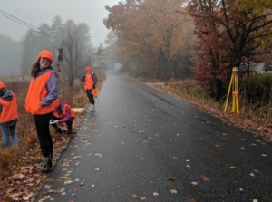
During 2019, UNH engineering seniors under the supervision of Engineering Professor and Georgetown Conservation Commission member Dr. Nancy Kinner again worked with Georgetown storm volunteers to collect data about whether certain culverts, estimated to fail at the 2 year storm, actually do flood the road. Volunteer “citizen scientists” are asked to go to a given culvert at a time during the daylight of their convenience, after a rain gauge at their home contains a certain amount of rainfall. Volunteers take photographs, from a pre-established vantage point, of the road (and any flooding) and a wooden color-coded elevation stake installed at the site. (The volunteers are not asked to go into any water.) The photos are then be uploaded to an internet storage site on a shared Google Drive and used by the students, along with the rainfall amount and duration, to determine the validity of the culvert failure estimates. These results were used in 2020 to verify the accuracy of the UNH model predicting culvert failure, and the team presented their findings to the Georgetown Road Commissioner (and co-sponsor) Charlie Collins, project volunteers and other interested Georgetown residents via ZOOM (due to COVID shutdown) in April 2020. View the full presentation here:
As climate change causes these extreme storms to happen with increasing frequency and as sea level rise adds another serious risk factor for our island community, this project enabling Georgetown to plan in advance for culvert maintenance and replacement is critical to ensure that our road network remains passable, and that families in Georgetown do not become stranded.
With sea level rise, the team will add effects of spring high tides in certain areas to the project in 2020-2021.
FMI or to volunteer for the 2020-2021 season, contact Conservation Commission member Professor Nancy Kinner at [email protected]


